Drone Flight Data can be used to measure piles of soil and rock on a property. Simply collect Ground Control Points, fly the site, register the data in the cloud. The data is accessed by you the customer 24/7 using a web browser based viewer. Simply draw a polygon around the pile, a 3D model of the pile drawn, and a report is generated.
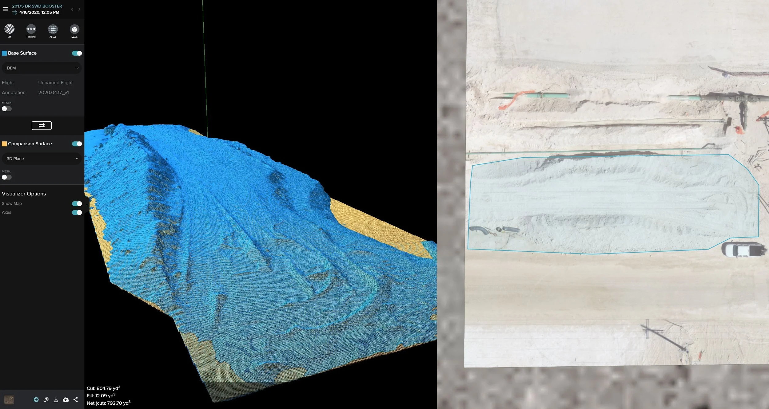
Drone Flight - Volume Measurements
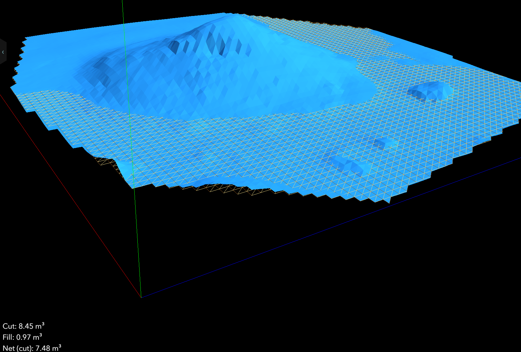
Drone Flight - 3D Model of Dirt Pile