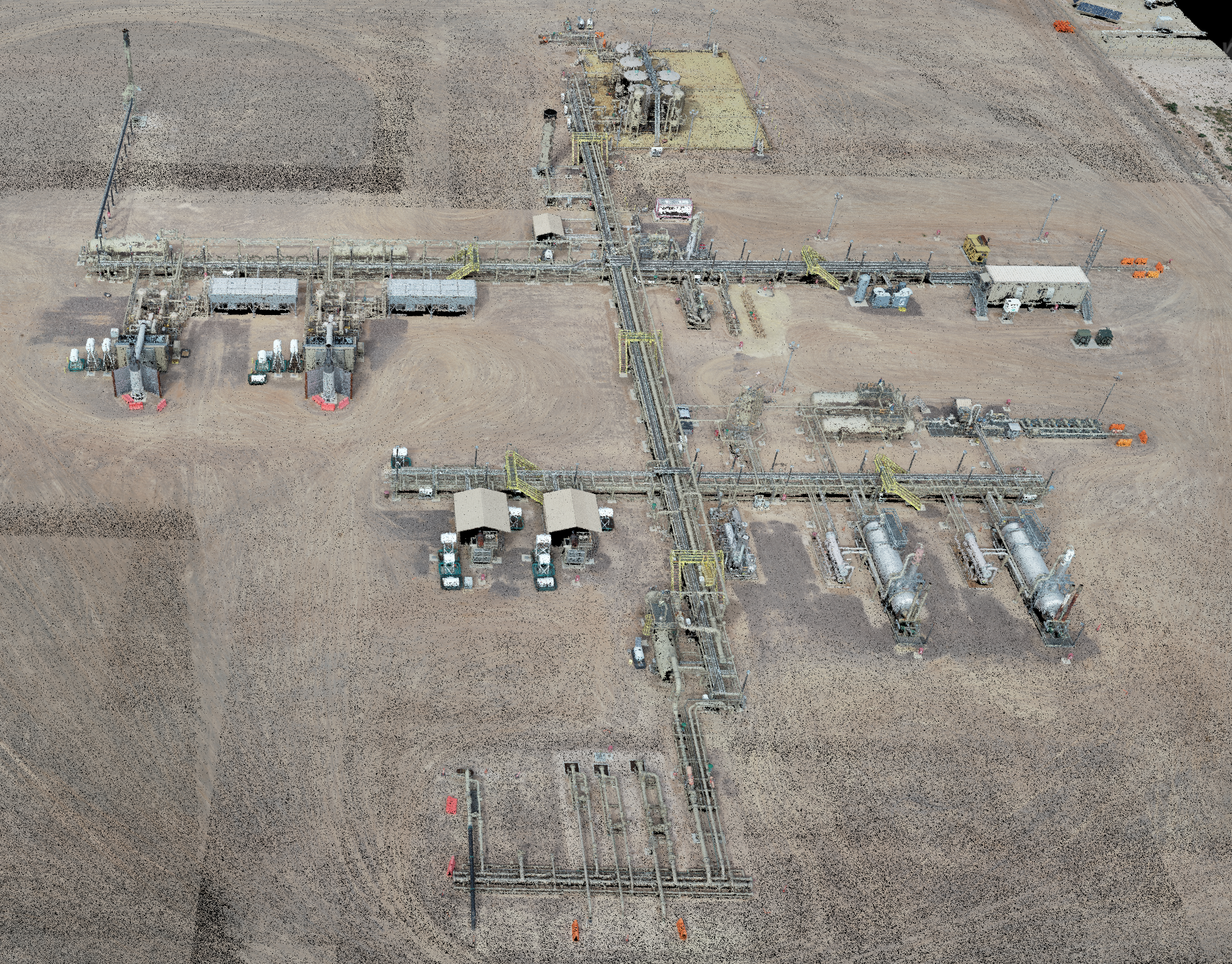
Drone Flight Data can be used in many different ways. As shown in this video, the photogrammetry captured by the drones can be turned into useful points cloud data that is dimensionally accurate. Giving us the ability to measure the heights of equipment and distances between equipment quickly and easily!

Drone Flight - Point Cloud Top View
Drone Flight - 3D Facility View
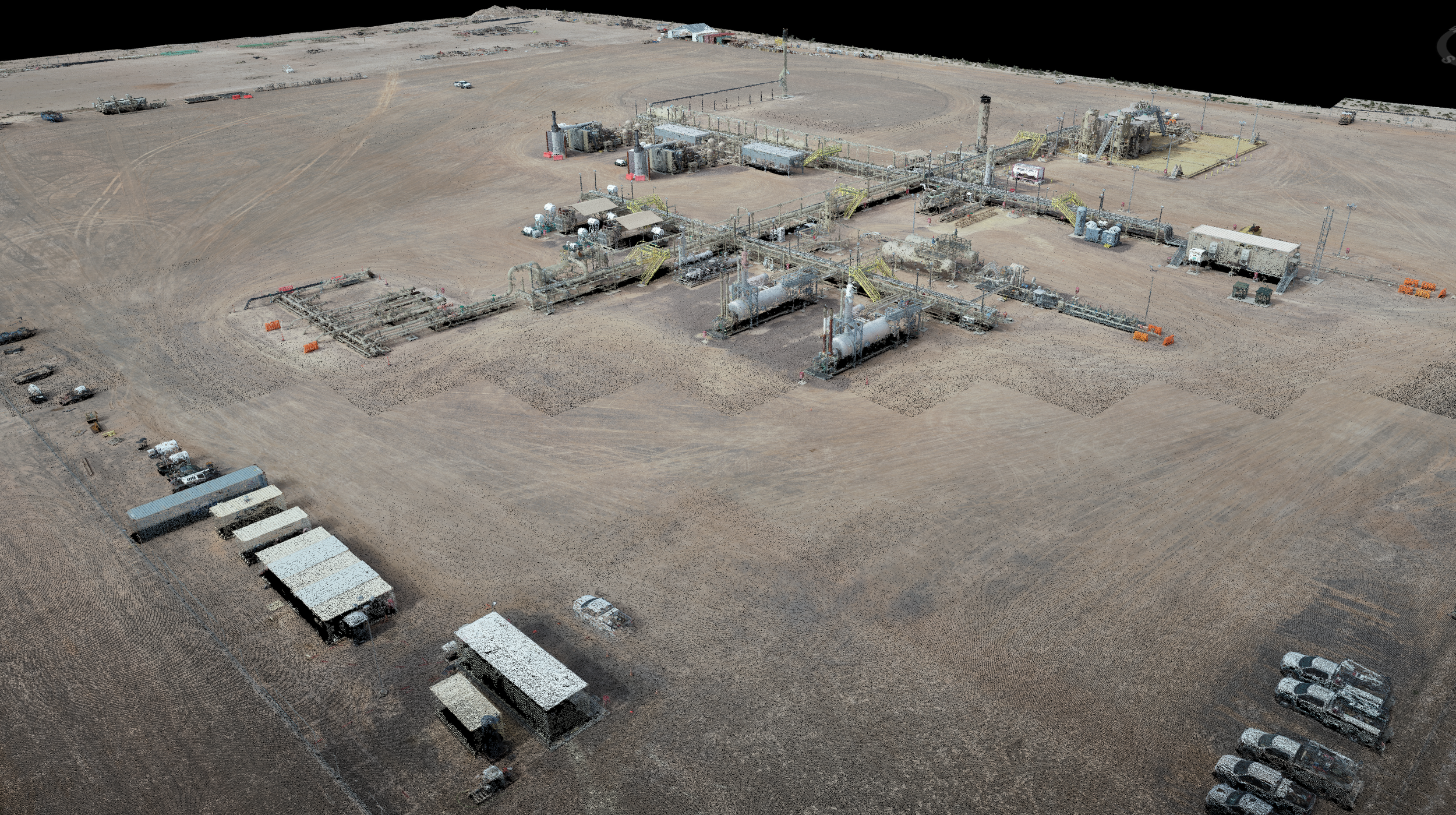
Drone Flight - 3D Facility View
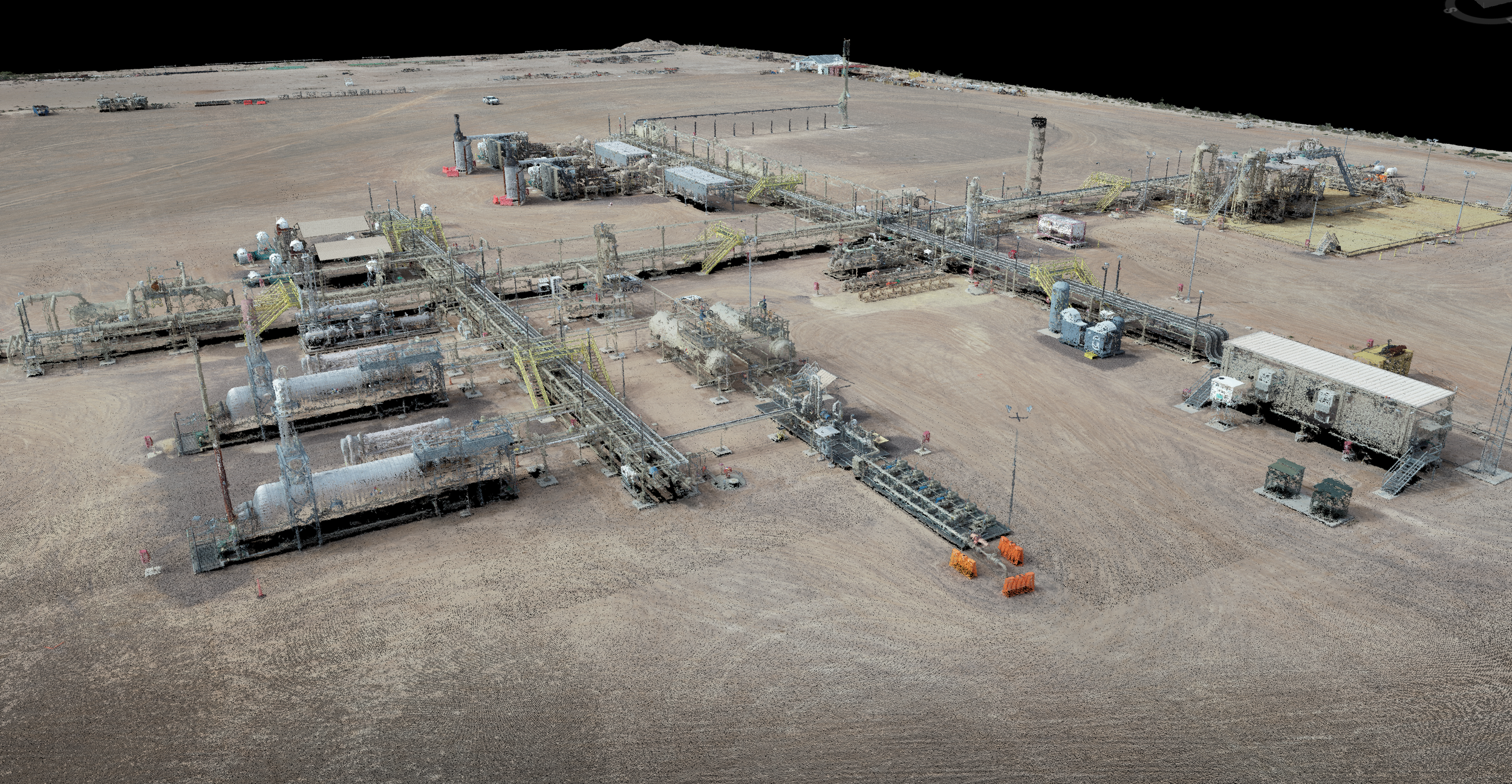
Drone Flight - 3D Facility View

Drone Flight - Sample Drone Photo

Drone Flight - Sample Drone Photo