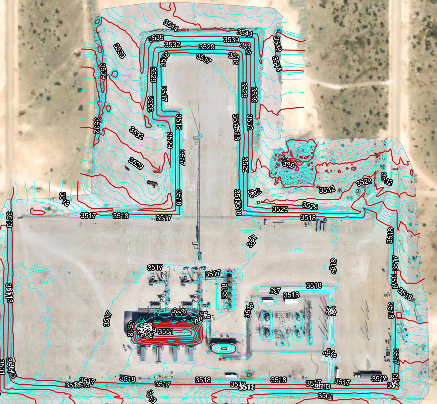
Drone Flights - Drainage Plans
Facility Capture is able to create a Drainage Plan using Drone Data, Esri Site Scan Registration tools, and Autodesk Civil 3D. Coming up with these types of workflows is key to a successful Drone Business.
Drone Flight - Contours Generated in Civil 3D
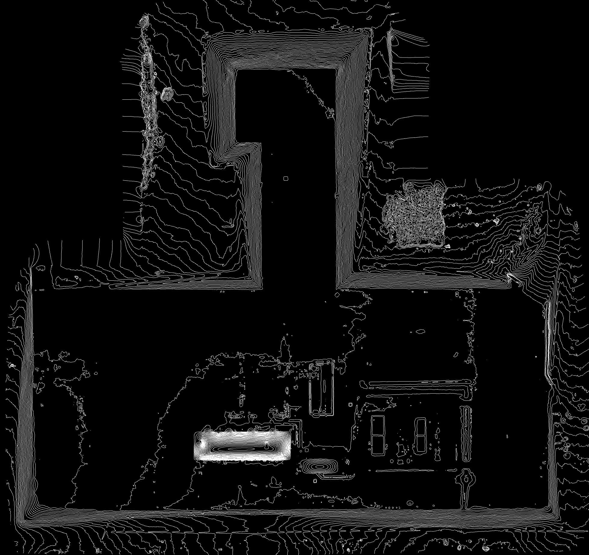
Drone Flight - Contours Auto-Generated
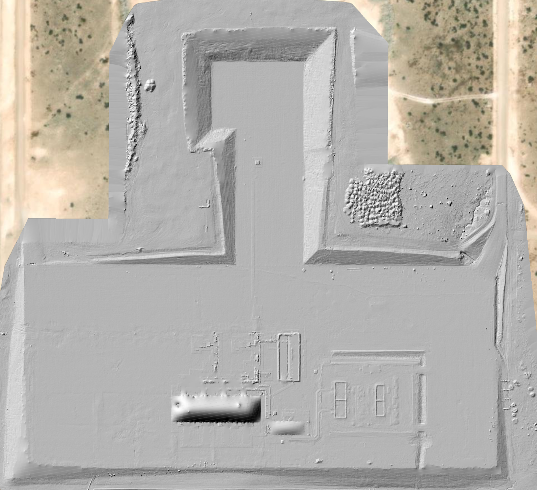
Drone Flight - Hill Mesh
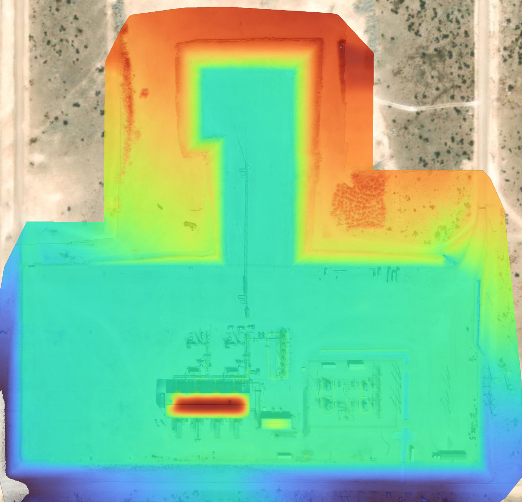
Drone Flight - Elevation Heat Map
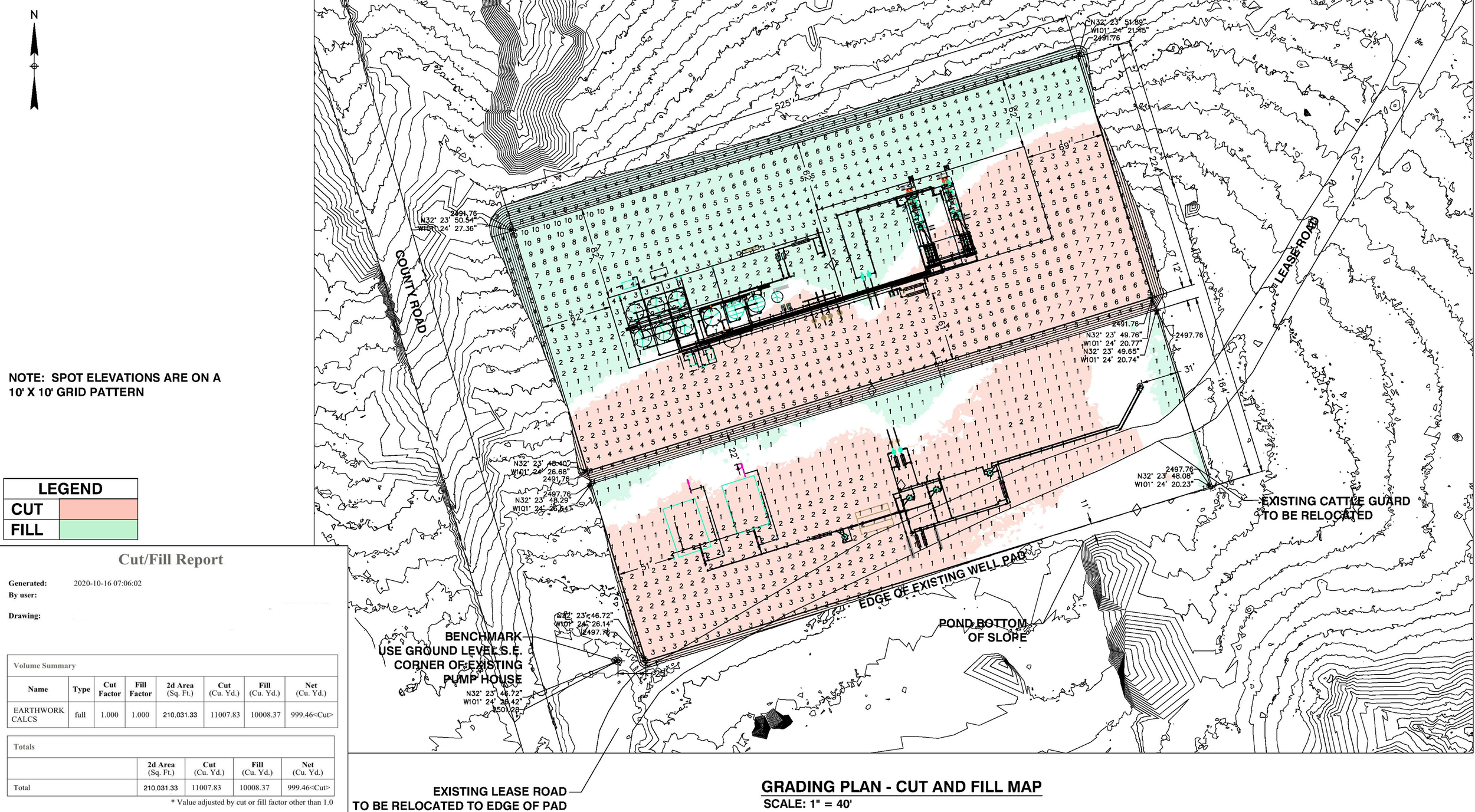
Drone Flight - Drainage & Cut & Fill Map
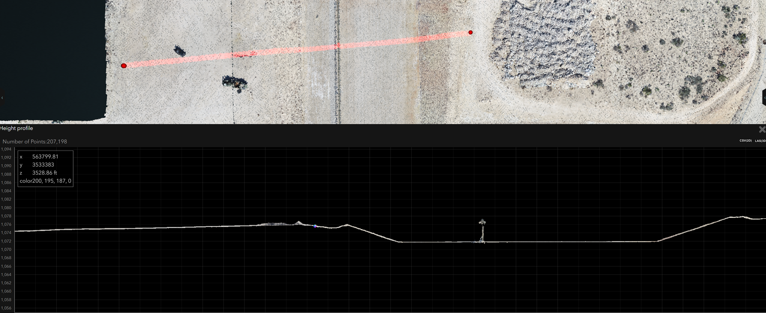
Drone Flight - Ground Profile